
Ansouis Patrimoine a créé deux chemins dans le village :
– Le circuit « Belle époque » fait de 6 agrandissements de cartes postales prises entre 1900 et 1930, placées à coté du lieu où la photographie a été prise (pastilles rondes bleus sur le plan). Ce circuit a était fait avec l’aide des Comptoirs d’Ansouis, association des commerçants du village.
– Le circuit historique, 10 panneaux devant les principaux monuments du village qui permettent au visiteur de s’informer sur le passé du village (pastilles carrées rouge sur le plan)
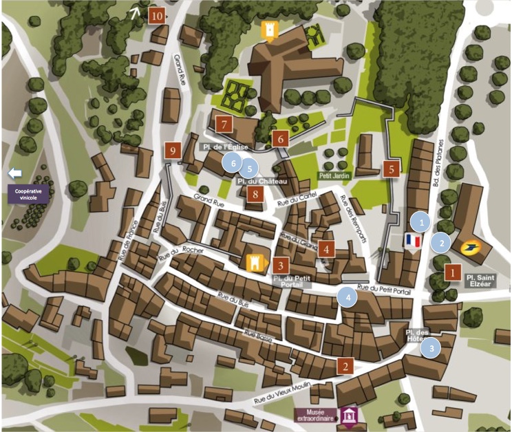
Vous trouverez ci-dessous la liste des panneaux historiques. En allant sur chaque description de panneau vous verrez le lien avec les cartes postales proches, les points d’interêts du village à proximité du panneau, et le lien vers des articles approfondissant chaque sujet.
